Written by Stephan Amm, Violeth Swai and Qaiser Hussain
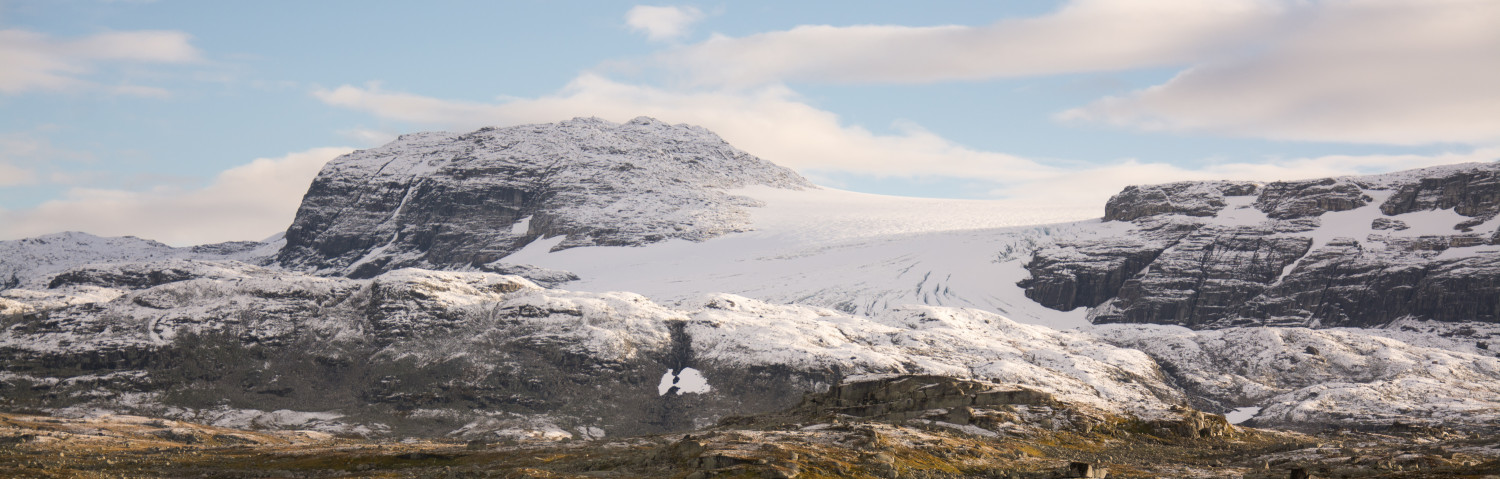
The path starts at the parking lot, follows the coastline and then continues on the dam south-west along the Koppangselva river into the valley. This valley has been formed and modified by glacial (Koppangsbreen), fluvial (Koppangselva river) and marine (tidal) processes. During the peak of the ice age (nearly 20 000 years ago), continental ice sheets and glaciers expanded. Based on the landforms in Koppangen valley (exposed fjord deltas) the local sea level during glaciation period was higher than that of today as the weight of overlying ice depressed the Earth’s crust. During the ice ages, such isostatic sea level changes happened throughout the evolution of ice on land. The presence of glaciers on land increases land’s weight and therefore decreases its height as it sinks slightly. Because of this, the sea level rises slightly. When the ice melts, the land begins to rise, and the sea level falls. This very slow effect is called isostatic rebound and still happens today.
On the other hand, a global sea level change, also called “eustatic” depends on the amount of water which is stored in the oceans. During an ice age when temperature drops, water freezes and is stored as ice on land. As water is being taken out of the ocean, the sea level drops. When the ice starts to melt, water is released into the ocean and the global sea level rises again. This interaction of eustatic and isostatic sea level change is the reason why geological and glacial features are found at different elevations than they were created.
Only little information about Koppangsbreen’s local advancing/retreating history exists as measurements of its height started just recently (around 1998). To understand the evolution of a glacier, a concrete relative (e.g., by correlation with other records in the same area) or absolute (e.g., direct age measurements) dating procedure must be performed.
In general, most glaciers in Lyngen advanced during the peak of the ice age period. By this time Koppangsbreen had occupied the valley and as it grows/moves within the valley it disintegrates surrounding rocks into fragments of different sizes (debris). These debris then pushed alongside and in front of the glacier as it moves then pile up to form ridges known as moraines. As the glacier retreats, moraines together with other features such as the floodplain, glacier-fed lakes and fjord delta become exposed.
Models and observational data e.g., satellite imagery, aerial photography, and laser scanning techniques on Koppangsbreen revealed a reduction in size of about 13% between year 1955-2010. Up to this time, the glacier drains to Koppangsvatnet lake (which was previously ice-dammed) and the valley downstream. In years 2010, 2011, 2013 and 2014 several jökulhlaups occurred in the Koppangen valley of small (2011) and large (2010) magnitudes. The 2010 jökulhlaup cut off a house downstream in the valley, while another flood in 2013 caused the evacuation of several houses as the river took a new course.
What is a jökulhlaup?
Is an Icelandic term for glacier flood. Geologists refer to the term jökulhlaups as a sudden release of large amounts of water from a subglacial or a proglacial lake. An ice dammed lake forms in, under or at the margin of a glacier and is to certain extent dammed by the glacier. The density of ice is lower than that of water. As the accumulation of the glacial meltwater in the ice-dammed lake continues, the ice on top of the heavier water floats and breaks eventually and a jökulhlaup occurs.
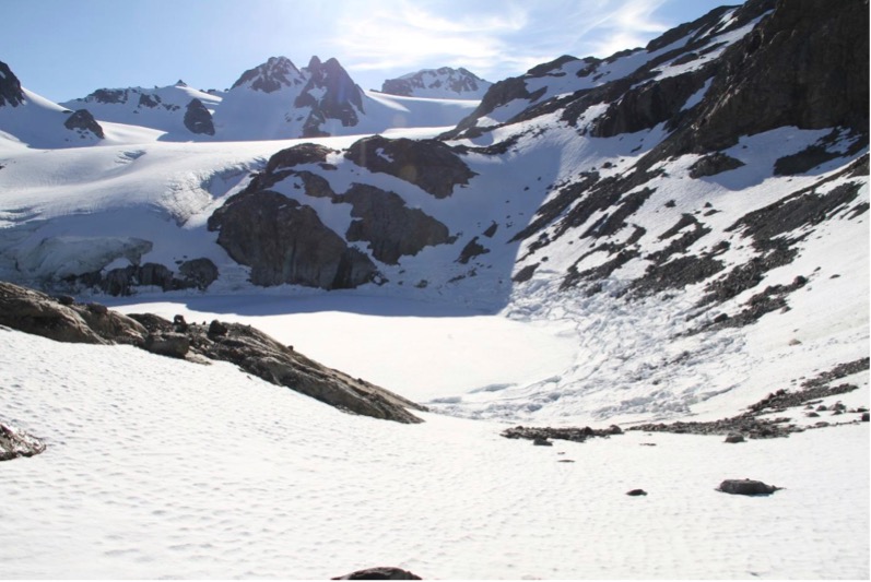
Figure 1: This picture, taken on June 5th, 2013, one day after the first jökulhlaups in 2013, shows the already-collapsed ice-dammed lake. Photo: Miriam Jackson, NVE
Stop 1: The dam
Placemark “destroyed fence”
On the southern side of the dam, you can see how the jökulhlaup events have damaged the fence and the area around it. The dam you walk on was constructed by the NVE (Norwegian water and energy directorate) in the summer of 2013 to prevent further downstream damage from the jökulhlaups and heavy snow melt events.
Stop 2: Fjord delta
On the opposite sides of the dam, the two vegetated ridges extended from the shoreline side toward the valley are fjord deltas. The ridge/bank that is situated close to the river channel is eroded enough to see a succession from angular boulders on top to fine and rounded sediments below. That is a moraine lying on the delta. This reflects the advancing of the glacier during glacial times, which came later after the deposition of delta, when sea level dropped.
Stop 3: Path through the forest (placemark “Start of path through forest”)
The trail takes you to the forest, along the river, which you must cross once, there you will start observing bent and broken trees. The direction and dip of some of these trees were measured. Those that are facing the meltwater stream are bending towards SE and E, whereas those trees that are away from the stream are mostly bending towards NE and E direction. There is high possibility that during the flood events (jökulhlaups), the trees near the riverbank were the most affected. On the other hand, those trees away from the riverbank but close to the mountains were affected by moving snow as a result of snow avalanches.
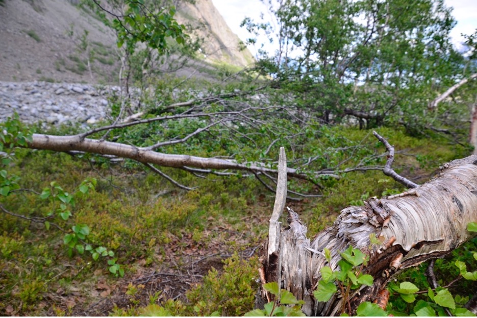
Figure 2: Evidence for jökulhaups and snow avalanches found in trees bending and broken towards the same direction. Photo: Willem van der Bilt
Stop 4: Cairns along the trail
The trail comprises two cairns, near the floodplain at an elevation of 98m (placemark “bottom cairn”; 69° 40′ 30,312″ N, 20° 13′ 38,772″ E) and at the top at 225m elevation (placemark “top cairn”; 69°40’30.73″ N, 20°13’13.82″ E) of the mountain towards the lake Koppangsvatnet (Figure 3). The later provides a spectacular view of all the features within and outside the floodplain.
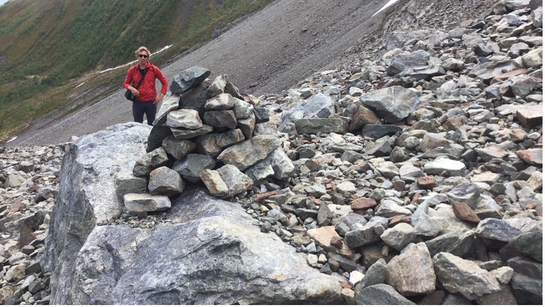
Figure 3: The cairn towards Lake Koppangsvatnet at an elevation of 225m. Photo: Violeth Swai
Stop 5: The floodplain system
During the hike along the river, we can observe this gigantic floodplain (Figure 4) that has been formed by strong water transport such as that of floods. A meandering river has its strongest energy in the bows. We can see clear traces of past channels, which indicate a dynamic river and meltwater system. Especially visible from a higher elevation is a transition zone that separates the flood plain (grey) and the non-flooded area (brownish colours). In this same brownish colour is a patch with several, a few years old trees.

Figure 4: This picture, taken from the slope towards East, shows the flood plain. The transition zone (brownish colour) in contrast to the flood plain (grey) is clearly visible. Photo: Stephan Amm
Stop 6: An erosional trace
On the left side of the glacial waterfall the trail will take you to the spectacular rocky mountain. Here you will need sturdy hiking gear. At the top, the view of the river channel through the flood plain below becomes magnificent.
At an elevation of 149m, look at the walls of the meltwater stream in front of you. There is a ten-meter high, greyish bank, which looks like it is cut into the bare rock (Figure 5). Features like that are typically formed during highly energetic, erosive events. These properties are mostly fulfilled by annually occurring meltwater events as well as a jökulhlaups.
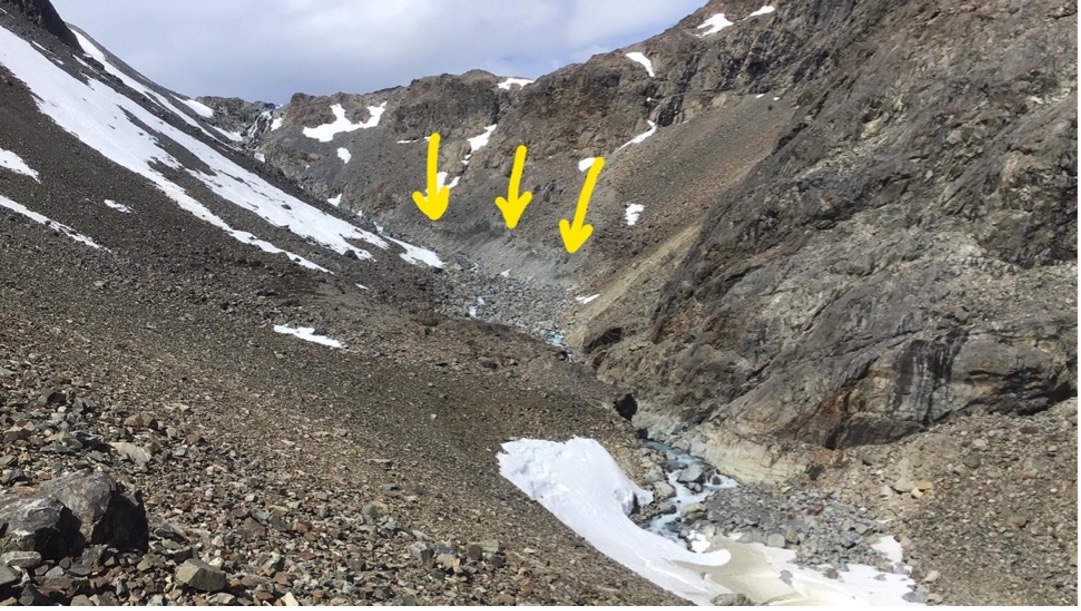
Figure 5: A cut bank (indicated by yellow arrows) is an evidence of a highly energetic, erosional event. Photo: Violeth Swai
The way back to the parking lot
Placemark “Start of alternate path back”; 69°40’30.06″N, 20°13’43.76″E
There are two possibilities to go back to the parking lot: either following the same way back, or towards the south along the slope and the forest. There, the snow avalanche fan (placemark “spot to see avalanches”), as well as rockfall to the west is clearly visible.
In this forest, especially in the area close to the slope, more of those bent and broken trees can be seen.
To observe more glacial features, it is advised to take the route back through the forest along a ridge parallel to the dam, behind an accumulation of angular boulders located to the South of the dam. This vegetated moraine you walk on, eventually thins out towards north-east and ends in a depression. This was formed as glacial ice, which got isolated from the melting glacier within a moraine, has melted out and caused the moraine to collapse. This ice is also called “dead ice”. The path then continues towards North on the dam.
NB: It is strongly advised to hike this trail with a good physical condition as well as proper hiking boots and equipment as the trail includes small climbs on bare rocks. The hike is recommended in summer when the valley is free of snow. The hike is at one’s own risk.

Figure 6: A Google Earth image showing the placemarks, hike and alternative path up Koppangen valley. Created with: Google Earth Pro